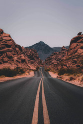
Whether you are exploring your neighborhood, your city, the United States, or the world, you need to understand how cities, countries, and continents make up the world. Geography is the study of places around the world and how they connect with each other. When you learn about geography, you learn about maps, physical places and landmarks, cultures, and how all of it ties together. Traveling by car across the United States or taking a seat on a plane headed around the world can be great ways to learn about geography, but you can get started learning about this subject just by looking at maps.
Continents
Earth is made up of large areas of land and large bodies of water. The large areas of land are called continents. The continents are North America, South America, Africa, Europe, Asia, Australia, and Antarctica. The water that covers Earth makes up more than 70 percent of the surface. The largest bodies of water are called oceans. The three biggest oceans are the Pacific, Atlantic, and Indian oceans, and there's also a smaller ocean called the Arctic Ocean. Some people also recognize a fifth ocean, called the Southern or Antarctic Ocean.
- Continents and Oceans
- Continents of the World
- Map of the World
- Continental Map
- The Seven Continents (PDF)
- Continents and Oceans Quiz
- Find the Continents and Oceans (PDF)
- The Travel Book (PDF)
- Teaching Continents (PDF)
- Introducing Continents (PDF)
The United States
The United States covers 3,794,083 square miles, and it has two major mountain ranges. The Rocky Mountains are in the western United States, and the Appalachian Mountains are in the eastern United States. One of the largest rivers is the Mississippi River, which flows from Minnesota all the way down to Louisiana and Mississippi. One of the most striking things about the United States is how many different types of landscapes make up the country. You can jump in the car and drive from deserts to mountains to beaches to prairies to forests and still not see everything there is to see.
- Understanding U.S. Geography and Weather (PDF)
- Map Quiz Game
- Name That State
- United States Puzzle Game
- Map Game
- Map Snap USA
- The States of the USA
- Statetris: USA
What Is Cartography?
Cartography is another word for map-making. If you've ever drawn a map, then you have done some of the things that a cartographer might do. A cartographer might create a map that shows the locations of cities, landmarks, rivers, mountains, roads, or buildings. People have been making maps for thousands of years. Before the invention of satellites in space that take pictures of Earth, people made maps by using complicated math equations to figure out where things are in relation to other things. Satellite images taken today make it possible to see exactly what Earth looks like, so maps can be very accurate and precise.
- Kid Cartographers
- As the World Turns: A Lesson on Maps for Kids
- Cartography: Map-Making
- Map-Making Guide (PDF)
- What Are Maps?
- The World in Spatial Terms (PDF)
- How Do We Teach Geography? (PDF)
- Types of Maps (PDF)
Maps and Their Features
A map is a physical model of Earth. A topographic map shows the features of Earth, such as mountains, lakes, and oceans. A climate map can show the typical weather in geographic locations. A political map shows things like cities, states, and countries and the boundaries between them. Maps can be flat, or they can be spherical (shaped like a ball). Spherical maps are called globes, and these types of maps show the actual shape of Earth. Maps are divided by lines that run north to south and east to west to make up a grid. The east-west lines are lines of latitude, and the north-south lines are lines of longitude. Each line has a number to help people find places on maps. The equator is at 0 degrees latitude, and the Prime Meridian is at 0 degrees longitude.
- How to Read a Topographic Map (PDF)
- A Grid on Our Earth: An Exploration on Map Grids
- Latitude and Longitude (PDF)
- Reading the World (PDF)
- Message in a Bottle (PDF)
- Latitude and Longitude (PDF)
- What Are Latitude and Longitude? (PDF)
Learning About Geography
Once you begin learning about geography, you may find the different cultures of the world fascinating. Even within the United States, people living in different regions often have different lifestyles. People living in different countries usually have very different lives due to their homes' histories, languages, and economies. Even if you don't travel all over the world, you can still explore the places on Earth with lessons, games, puzzles, and quizzes.
- Physical Geography Game
- Let's Explore the World
- GeoSpy Game
- Where Is That?
- Globetrotter Game
- Easy Geography Trivia (PDF)
- Social Studies Questions and Answers (PDF)
- What are the seven continents of the world?
- The seven continents are North America, South America, Africa, Europe, Asia, Australia, and Antarctica.
- How does geography help us understand the world?
- Geography helps us understand places, cultures, and how different areas connect, enhancing our knowledge of the world.
- What is cartography?
- Cartography is the art and science of map-making, which involves creating visual representations of geographic areas.
- What types of maps are commonly used?
- Common types of maps include political maps, physical maps, topographic maps, climate maps, and thematic maps.
- How can I learn about geography without traveling?
- You can learn about geography through maps, online resources, educational games, quizzes, and reading about different cultures.


